Welcome

Thank you for visiting our website. The purpose of our website is to introduce our emerging development plans for land at Firs Way and for you to be able to have your say on the draft proposals. We are keen to hear your feedback so that it can be taken into account as we prepare our planning application.

This consultation runs until Monday 9th March – you can have your say through the feedback form below. Comments will be treated confidently but will be summarised in our application submission alongside an explanation of how we have taken your views into account.

Background Context

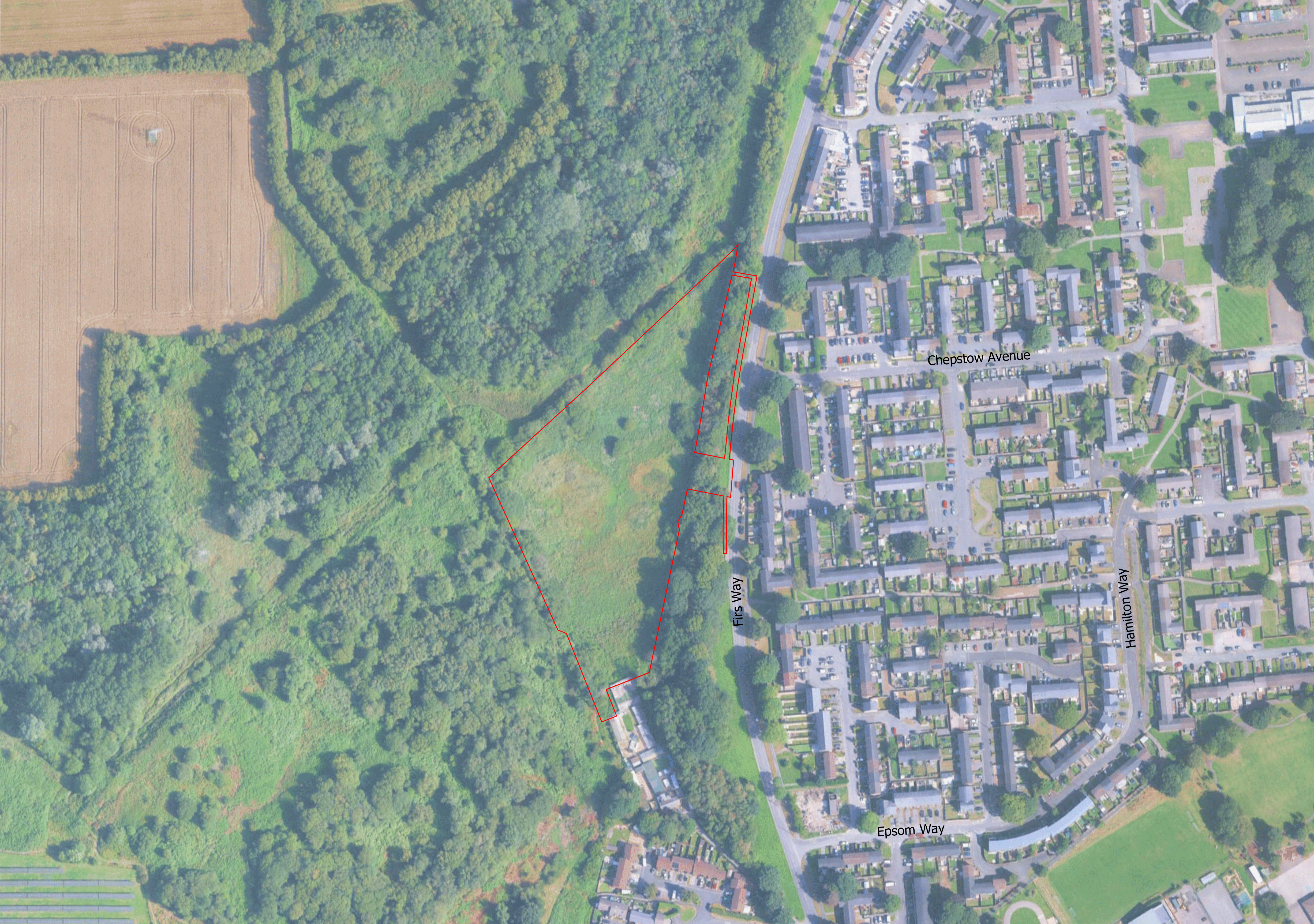
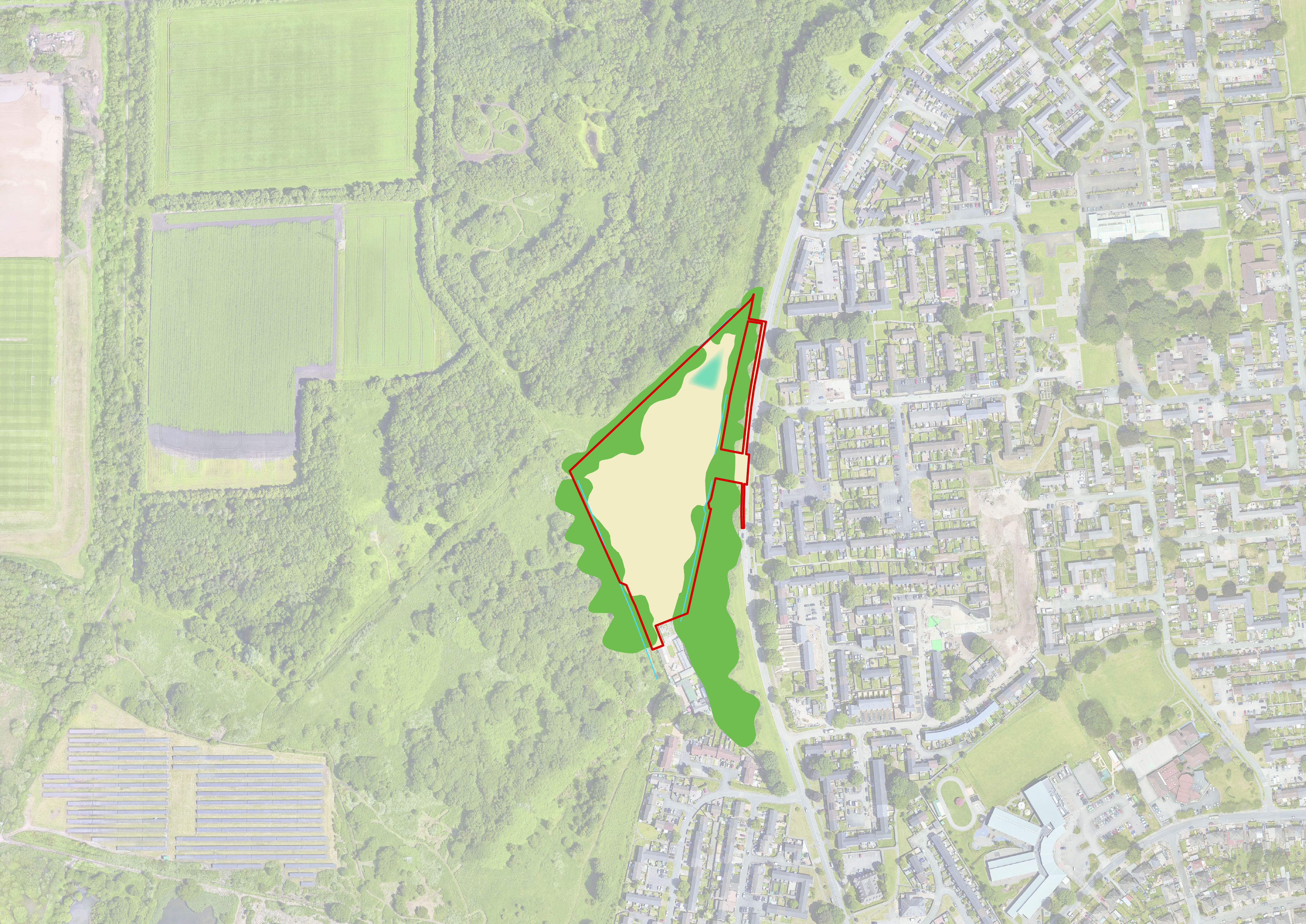
The Site extends to approximately 2.0 hectares and is located off Firs Way at the western edge of the built-up area of Sale, in the borough of Trafford. It comprises an area of open ground that is triangular shaped and generally level.

The Site is allocated for residential development in the strategic spatial development plan ‘Places for Everyone’ as part of the wider JPA30 (New Carrington), and forms part of the eastern extent of this allocation.

Vision for the site

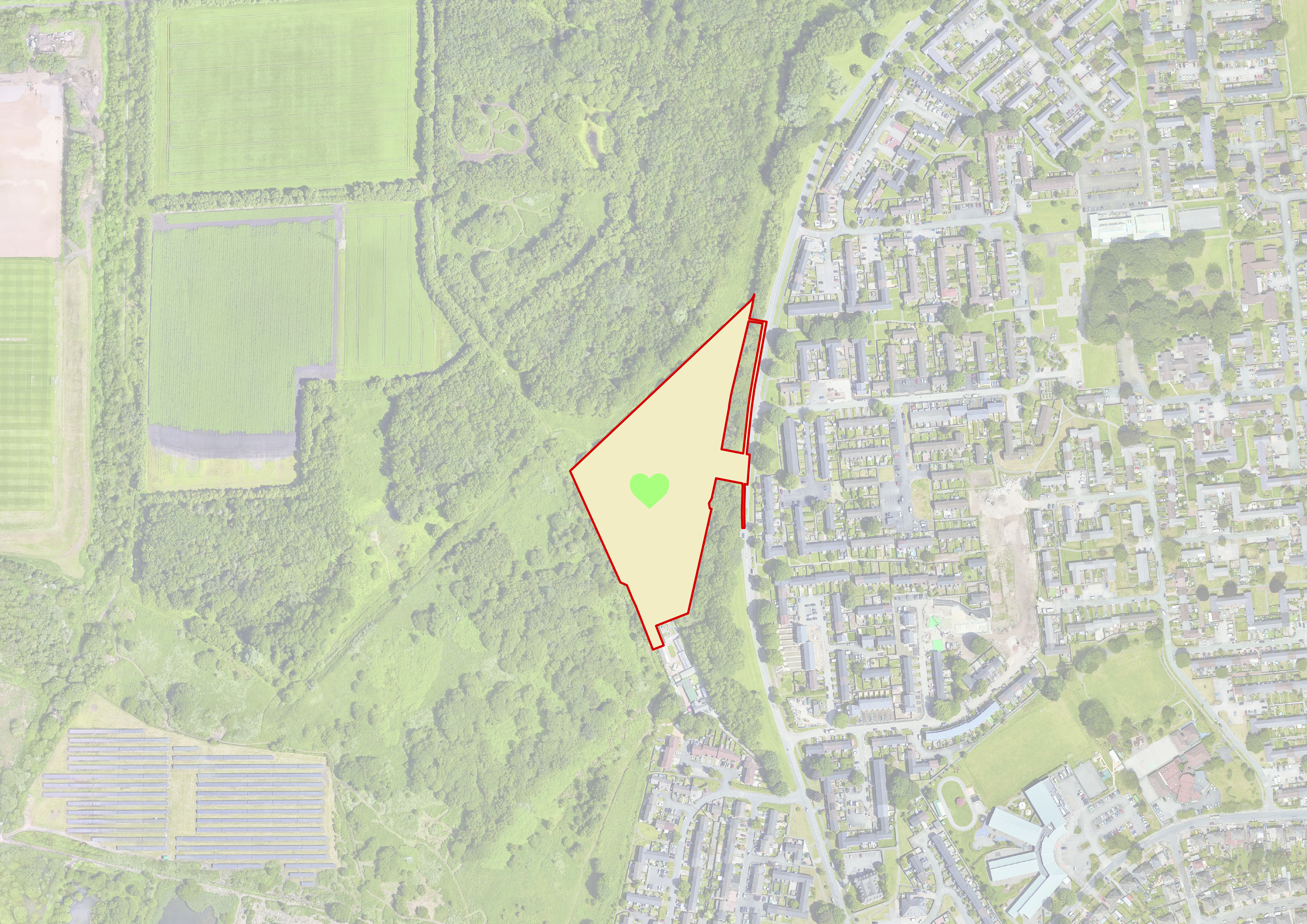
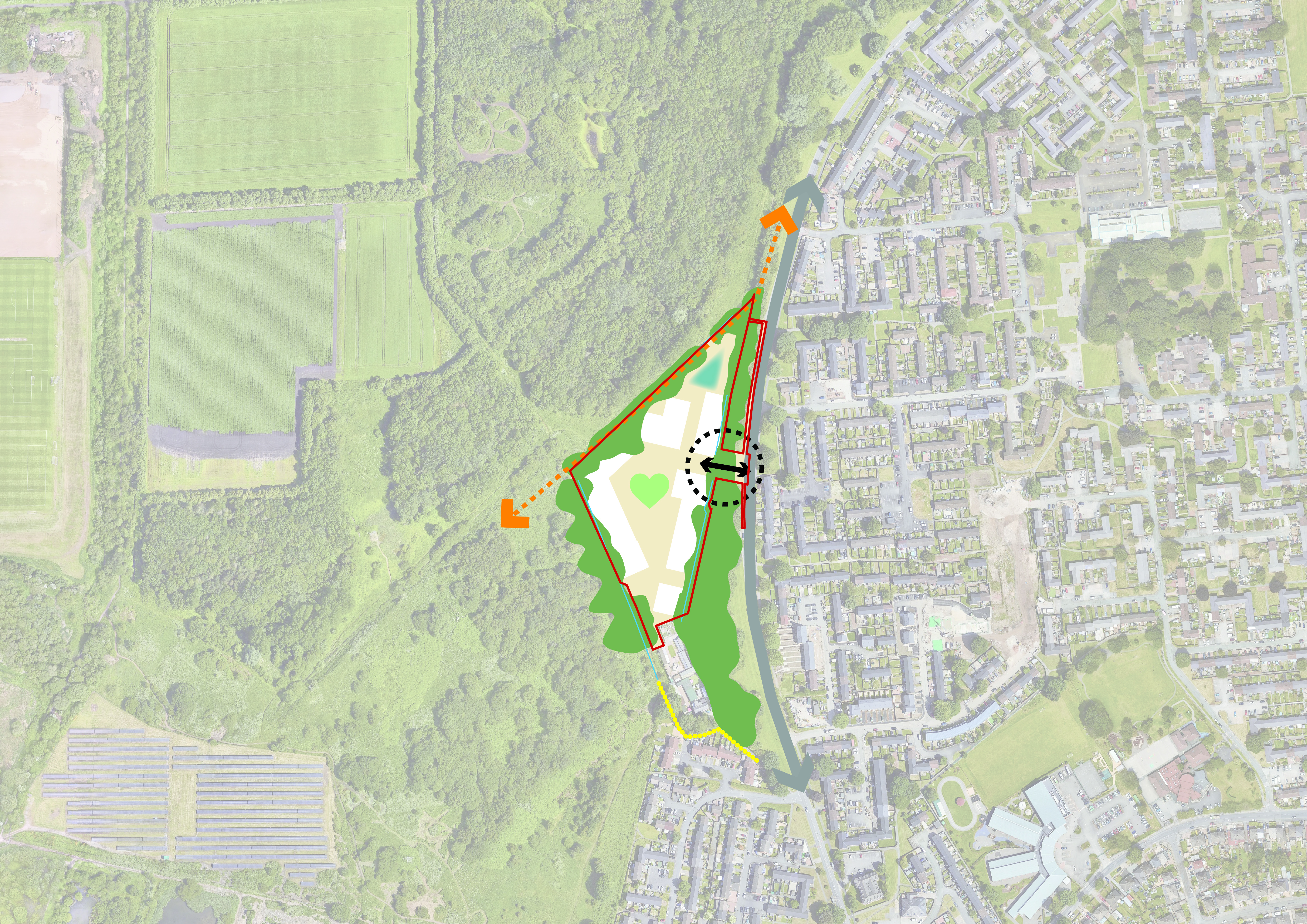
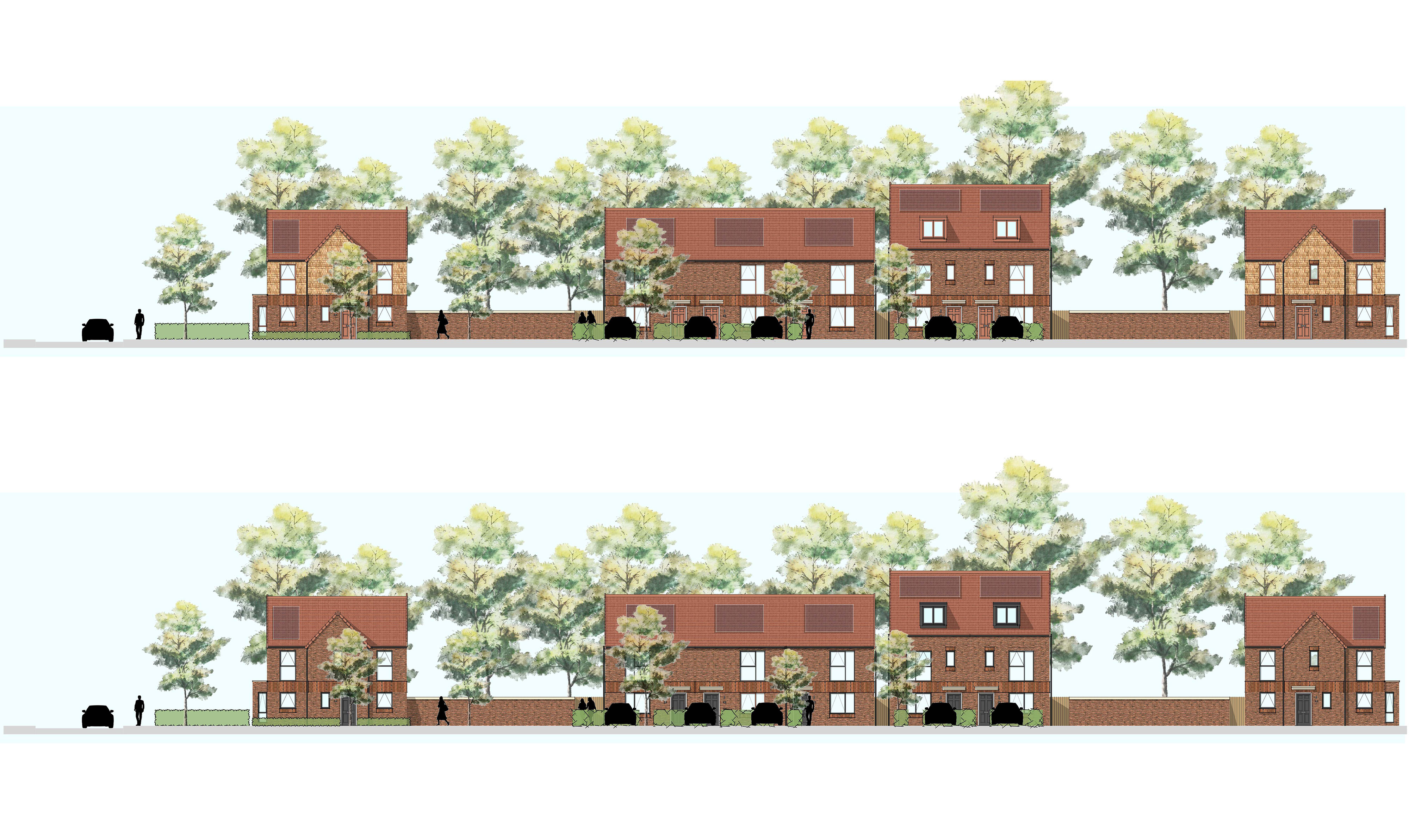
The proposals will deliver a new sustainable and attractive community that will seamlessly integrate into the surrounding context.

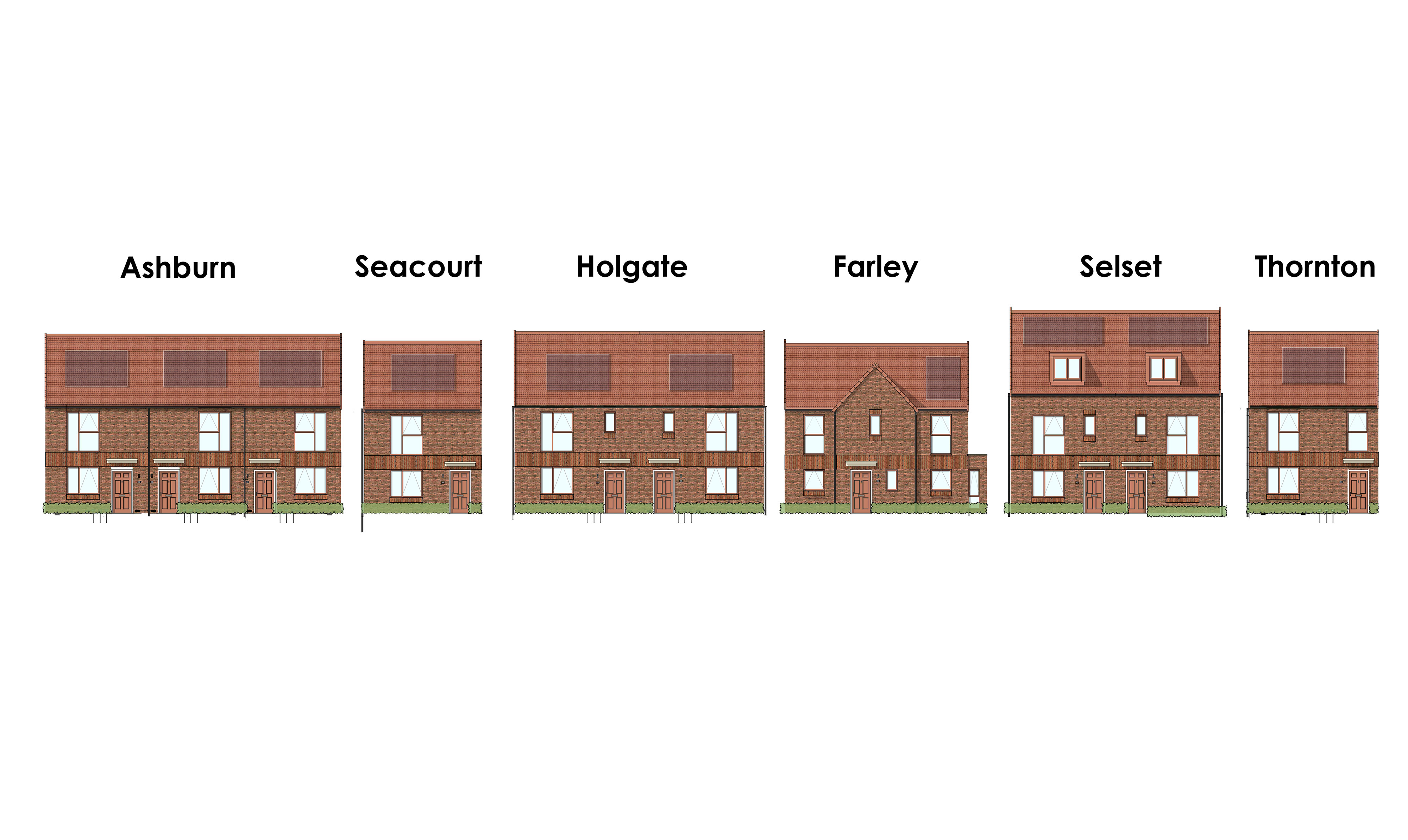
With high-quality and sustainable design principles at its heart, the development will provide 53 new homes, 100% of which will be affordable. The proposals include new connections for pedestrians and cyclists to the green spaces which surround the site.

The proposals will provide a range of 2, 3 and 4 bedroom homes to cater for all needs, from first time buyers to downsizers. All homes have been designed to be highly efficient in energy performance and provide ample living space for residents.

Existing habitats are an important consideration in the future development of the site and the site’s green assets will be retained and protected as part of the development as far as possible. A net gain in biodiversity will be achieved through the provision of on-site biodiversity and off-site measures.

Site & Surroundings

The Site lies to the west of the A56 which has direct connections to the M60. The site in a sustainable location and benefits to direct connections existing public rights of way, public transport services and the local and strategic road networks.

PfE Allocation Mapping
Site Location Plan (Click to enlarge)

The Site

The site is located on the western edge of Sale approximately 2.5km south-west of Sale Town Centre

The site measures 2.21 ha, is triangular in shape and enclosed by existing mature trees.

The site is bound by publicly accessible open space to the north and west, Moss Cottage Kennels and Cattery to the south and existing residential development to to the east.

The site is allocated for residential development as part of the wider New Carrington Masterplan.

Key Amenities

There are three High schools in the vicinity - Ashton on Mersey School, Sale High School, and Sale Grammar School. The nearest primary school is located approximately 1km to the north-east of the site and the nearest primary school is St Margaret Ward Catholic Primary School located approximately 0.5km to the east; providing educational facilities within a walking distance.

The Sale West Community Centre is located within an 8-minute walk east from the site, and the Firs Way Health Centre is located within a 10-minute walk providing good access to medical pharmacy services.

Within the adjoining Estate which lies to the east of the Site, there is a Tesco Express, Co-Op Food Store, Coppice Library and Wellbeing Centre, ATM and a public house, the Samuel Brooks.

To the west lies open space, including Carrington Moss, a local nature reserve, and the Firs Way Woodland and Transpennine Trail. A maturing woodland group lines the eastern boundary and overhangs into the site. The Site has the potential to support bats and newts which we will ensure are protected as part of the development. Opportunities for new habitats will also be provided as part of the proposals.

The site is bound by Firs Way to the east with existing residential development beyond. Directly to the south is the Moss Cottage Kennels and Cattery.

The Site is largely free from environmental and technical constraints. It is located within Flood Zone 1 (lowest risk of flooding), away from any heritage assets and outside of any Air Quality Management Area.

Masterplan Principles

Green & Blue Infrastructure
Access & Movement
Access & Movement
Placemaking
Delivery of new publicly accessible open space
Development
Developable Area

Opportunities and Constraints

Constraints and opportunities on the Site have been carefully considered and have been incorporated into the design of the proposed scheme.

These include:

  1. The Site’s low point in the north has provided a natural location for an attenuation pond.
  2. Existing water courses run adjacent to the Site, these have had a buffer applied and respected where possible.
  3. Existing trees and associated Root Protection Areas have been respected and have helped to define developable area.
  4. Public right of ways and existing paths (Transpennine trail) surrounding the Site have provided the opportunity for strong movement corridors north south and east west.
  5. Existing breaks in the surrounding trees provide natural pedestrian gateways out of the Site connecting to the wider network of paths.
  6. It will be necessary to mitigate any noise from the kennels to the south of the site.
  7. A number of bus shelters are situated within close proximity of the Site.

These opportunities and constraints have shaped the design response for the Site

Opportunities and Constraints (Click to enlarge)

The Masterplan

The layout responds positively to the Site’s opportunities and constraints. Direct access to extensive areas of Public Open Space is provided to the west / north of the Site alongside a mix of housing types that are proposed for varied choice across the Site.

Masterplan
Masterplan (Click to enlarge)

Masterplan Benefits features include:

  • Delivery of 53 much needed new homes comprising of 2,3 & 4 bedroom dwellings.
  • 100% affordable scheme which includes the opportunity for assisted home ownership.
  • Provision of a range of housing types, such as detached, terraced and semi-detached housing.
  • New pedestrian and cycle routes through the Site providing new connections to the existing green infrastructure and transport network which surrounds the site.
  • Incorporation of sustainable urban drainage systems.
  • High quality architecture which positively responds to both the urban and rural surrounding context.
  • On-site and off-site measures to improve biodiversity with the creation of new habitats on-site.

Materiality & Housetypes

  • Site Image
  • Site Image
  • Site Image
  • Site Image

Next Steps & Timeline

  • Consultation period to run from Monday 23rd February to 9th March
  • All feedback will be considered during this period with an opportunity to incorporate feedback
  • Full planning application to be submitted Spring/Summer 26
  • Target start on site date
  • Target completion date

Contact Us

If you have any comments or questions or would like a hard copy of any of our consultation materials, please contact us.